On Sunday, 188,000 people were evacuated from the towns surrounding California’s Oroville Dam, after the discovery of a hole in the main spillway raised fears of flash floods and large-scale deluge. How dangerous is the situation? What’s being done to fix it? How long are the evacuation going to last? These are just a few of the questions we’re looking to answer.

Where is the Oroville Dam?
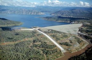
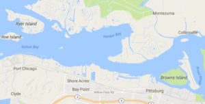
The official Lake Oroville website (lakeoroville.net) informs us that the Oroville Dam was built between 1962 and 1967, standing tall at 770 feet, the tallest dam in the United States. It is situated about 150 miles northeast of San Francisco, in the Sierra Nevada foothills. The main purpose of the dam is to supply water, generate electricity and provide flood control, by keeping in check Lake Oroville, one of the biggest lakes in the state of California.
What’s happening at the Oroville Dam?
After heavy rain this winter- Lake Oroville water levels have risen considerably, threatening to overflow the dam, which has led to water being evacuated through the main spillway.
The dam has two spillways to release water in case of overflow, but both spillways seem to have problems. Last week, a 200-foot-long, 30-foot-deep hole was discovered in the main, concrete-lined spillway. The hole is believed to have appeared because of erosion and negligence, and, because of its dimensions it cannot be fixed quickly. (more…)


